 vesseltracker.com
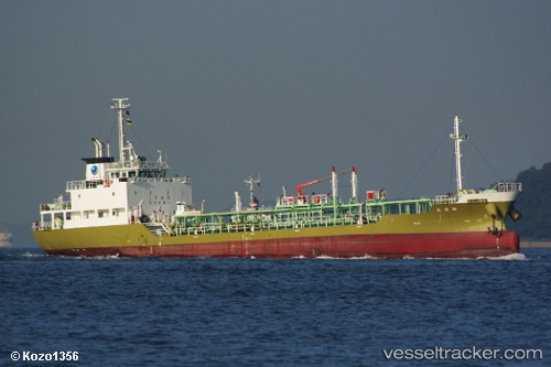
 Shinyo Maru
Current Status
Where is the vessel?
Shinyo Maru is currently in Near FUKUYAMA, based on AIS data received about 1h ago.
Latest AIS update:
Current position: 34.47284° N, 133.44592° E (Near FUKUYAMA)
Average speed (last 7 days): Loading…
Average speed (last 30 days): Loading…
Vessel profile: Shinyo Maru is a Chemical Oil Products Tanker with dimensions 72m x 11m.
This page combines live AIS, route history, probable destination signals, nearby traffic, and port activity for practical vessel monitoring.
The current position of vessel Shinyo Maru is 34.47284 lat / 133.44592 lng. Updated: 2026-04-13 03:12:47 UTCNearest reference points:
- Near FUKUYAMA
- Near MIZUSHIMA
- Near Kurashiki
Currently sailing under the flag of Japan ![]()
Details:
Live Vessel Shinyo Maru Analytics (details, animations, etc.)
Recent AIS points (UTC):
2026-04-12 21:54:19 UTC · 34.41500, 133.46832 · SOG 0 kn · COG -1°2026-04-12 23:40:35 UTC · 34.41654, 133.46870 · SOG 0 kn · COG 119°
2026-04-13 02:27:14 UTC · 34.41500, 133.46832 · SOG 0 kn · COG -1°
2026-04-13 03:12:47 UTC · 34.47284, 133.44592 · SOG 0 kn · COG 1°