 vesseltracker.com
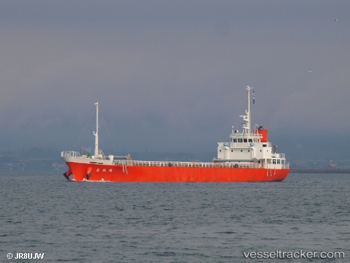
Sireimaru
Current StatusWhere is the vessel?
Sireimaru is currently in Near Sensyu, based on AIS data received less than 1h ago.
Latest AIS update:
Current position: 34.38510° N, 135.15292° E (Near Sensyu)
Average speed (last 7 days): Loading…
Average speed (last 30 days): Loading…
Vessel profile: Sireimaru is a General Cargo Ship with dimensions 12m x 75m.
This page combines live AIS, route history, probable destination signals, nearby traffic, and port activity for practical vessel monitoring.
The current position of vessel Sireimaru is 34.38510 lat / 135.15292 lng. Updated: 2026-04-06 15:42:16 UTCNearest reference points:
- Near KADA
- Near Awaji
- Near Hyogo
Details:
Live Vessel Sireimaru Analytics (details, animations, etc.)
Recent AIS points (UTC):
2026-04-06 10:10:49 UTC · 34.41465, 134.41158 · SOG 11.5 kn · COG 70°2026-04-06 11:35:59 UTC · 34.52095, 134.71609 · SOG 11.2 kn · COG 64°
2026-04-06 13:36:49 UTC · 34.59162, 135.06058 · SOG 8.9 kn · COG 134°
2026-04-06 15:42:16 UTC · 34.38510, 135.15292 · SOG 0.3 kn · COG -1°