 vesseltracker.com
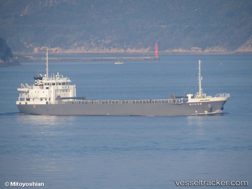
 Shin Sakai Maru
Current Status
Where is the vessel?
Shin Sakai Maru is currently in Near Iruma, based on AIS data received about 1h ago.
Latest AIS update:
Current position: 34.59172° N, 138.90448° E (Near Iruma)
Average speed (last 7 days): Loading…
Average speed (last 30 days): Loading…
Vessel profile: Shin Sakai Maru is a General Cargo Ship with dimensions 84m x 84m.
This page combines live AIS, route history, probable destination signals, nearby traffic, and port activity for practical vessel monitoring.
The current position of vessel Shin Sakai Maru is 34.59172 lat / 138.90448 lng. Updated: 2026-04-21 10:12:06 UTCNearest reference points:
- Near Iruma
- 10 nm SE of Iruma
- Near Toshima/Tokyo
Currently sailing under the flag of Japan ![]()
Details:
Live Vessel Shin Sakai Maru Analytics (details, animations, etc.)
Recent AIS points (UTC):
2026-04-21 06:55:18 UTC · 35.01138, 139.54868 · SOG 11.9 kn · COG 231°2026-04-21 07:37:29 UTC · 34.92320, 139.41467 · SOG 12 kn · COG 231°
2026-04-21 10:12:06 UTC · 34.59172, 138.90448 · SOG 14 kn · COG 254°
2026-04-21 10:12:06 UTC · 34.59172, 138.90448 · SOG 14 kn · COG 254°