 vesseltracker.com
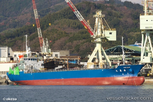
 Taihoumaru
Current Status
Where is the vessel?
Taihoumaru is currently in Near Narashino, based on AIS data received less than 1h ago.
Latest AIS update:
Current position: 35.68784° N, 139.95415° E (Near Narashino)
Average speed (last 7 days): Loading…
Average speed (last 30 days): Loading…
Vessel profile: Taihoumaru is a General Cargo Ship with dimensions 75m x 12m.
This page combines live AIS, route history, probable destination signals, nearby traffic, and port activity for practical vessel monitoring.
The current position of vessel Taihoumaru is 35.68784 lat / 139.95415 lng. Updated: 2026-04-20 08:21:42 UTCNearest reference points:
- Near ANEGASAKI
- Near Aomi
- Near Kawasaki
Currently sailing under the flag of Japan ![]()
Details:
Live Vessel Taihoumaru Analytics (details, animations, etc.)
Recent AIS points (UTC):
2026-04-20 04:23:20 UTC · 35.61279, 139.96562 · SOG 0.1 kn · COG 245°2026-04-20 05:41:24 UTC · 35.61302, 139.96436 · SOG 0 kn · COG 125°
2026-04-20 07:11:43 UTC · 35.64129, 139.97247 · SOG 10.5 kn · COG 332°
2026-04-20 08:21:42 UTC · 35.68784, 139.95415 · SOG 0 kn · COG 351°