 vesseltracker.com
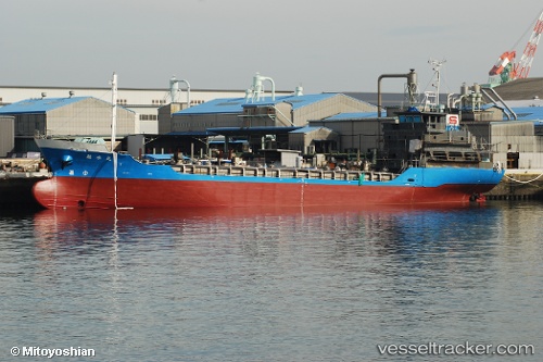
 Kakusui Maru
Current Status
Where is the vessel?
Kakusui Maru is currently in Near Iwata, based on AIS data received about 1h ago.
Latest AIS update:
Current position: 34.61288° N, 137.75554° E (Near Iwata)
Average speed (last 7 days): Loading…
Average speed (last 30 days): Loading…
Vessel profile: Kakusui Maru is a Chemical Tanker with dimensions 64m x 10m.
This page combines live AIS, route history, probable destination signals, nearby traffic, and port activity for practical vessel monitoring.
The current position of vessel Kakusui Maru is 34.61288 lat / 137.75554 lng. Updated: 2026-04-01 15:52:35 UTCNearest reference points:
- 17 nm SW of OMAEZAKI
- 17 nm S of TOYOHASHI
- Near TOYOHASHI
Currently sailing under the flag of Japan ![]()
Details:
Live Vessel Kakusui Maru Analytics (details, animations, etc.)
Recent AIS points (UTC):
2026-04-01 10:15:35 UTC · 34.71483, 139.04842 · SOG 12 kn · COG 211°2026-04-01 11:41:24 UTC · 34.58407, 138.77248 · SOG 11.8 kn · COG 268°
2026-04-01 14:24:55 UTC · 34.58793, 138.12042 · SOG 12.3 kn · COG 279°
2026-04-01 15:52:35 UTC · 34.61288, 137.75554 · SOG 12.2 kn · COG 266°