 vesseltracker.com
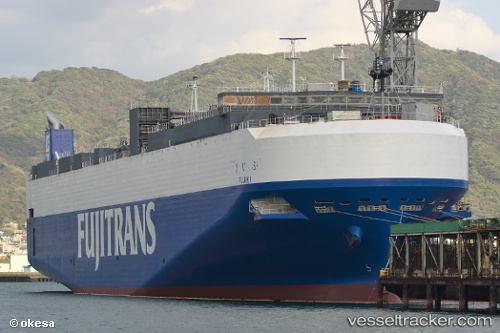
 Fujiki
Current Status
Where is the vessel?
Fujiki is currently in 21 nm NE of Hachinohe, based on AIS data received less than 1h ago.
Latest AIS update:
Current position: 40.81937° N, 141.82851° E (21 nm NE of Hachinohe)
Average speed (last 7 days): Loading…
Average speed (last 30 days): Loading…
Vessel profile: Fujiki is a Vehicles Carrier with dimensions 167m x 30m.
This page combines live AIS, route history, probable destination signals, nearby traffic, and port activity for practical vessel monitoring.
The current position of vessel Fujiki is 40.81937 lat / 141.82851 lng. Updated: 2026-04-06 12:12:23 UTCNearest reference points:
- 26 nm E of Hachinohe
- Near Yokohama, Aomori
- 11 nm NW of Yokohama, Aomori
Currently sailing under the flag of Japan ![]()
Details:
Live Vessel Fujiki Analytics (details, animations, etc.)
Recent AIS points (UTC):
2026-04-06 01:40:38 UTC · 42.64083, 141.62141 · SOG 0 kn · COG 335°2026-04-06 07:39:05 UTC · 42.47993, 141.61868 · SOG 21.8 kn · COG 178°
2026-04-06 09:51:57 UTC · 41.67993, 141.65019 · SOG 22.6 kn · COG 175°
2026-04-06 12:12:23 UTC · 40.81937, 141.82851 · SOG 22.4 kn · COG 170°