 vesseltracker.com
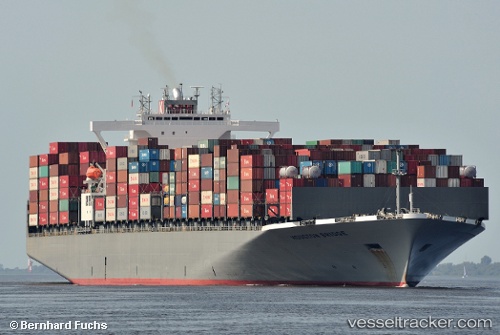
 ONE HOUSTON
Current Status
Where is the vessel?
ONE HOUSTON is currently in 60 nm E of Krustetten, based on AIS data received about 1h ago.
Latest AIS update:
Current position: 48.23706° N, 152.50229° W (60 nm E of Krustetten)
Average speed (last 7 days): Loading…
Average speed (last 30 days): Loading…
Vessel profile: ONE HOUSTON is a Container Ship with dimensions m x m.
This page combines live AIS, route history, probable destination signals, nearby traffic, and port activity for practical vessel monitoring.
The current position of vessel ONE HOUSTON is 48.23706 lat / -152.50229 lng. Updated: 2026-04-22 13:52:37 UTCCurrently sailing under the flag of Japan ![]()
Details:
Live Vessel ONE HOUSTON Analytics (details, animations, etc.)
Recent AIS points (UTC):
2026-04-22 10:55:47 UTC · 47.98045, -151.19080 · SOG 18.7 kn · COG 286°2026-04-22 12:00:30 UTC · 48.07682, -151.66940 · SOG 18.6 kn · COG 286°
2026-04-22 13:43:29 UTC · 48.22418, -152.43518 · SOG 18.5 kn · COG 285°
2026-04-22 13:52:37 UTC · 48.23706, -152.50229 · SOG 18.4 kn · COG 285°