 vesseltracker.com
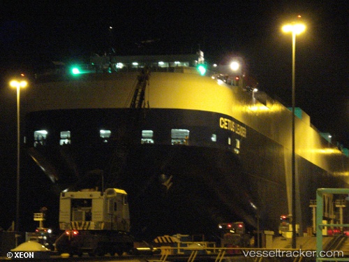
Cetus Leader
Current StatusWhere is the vessel?
Cetus Leader is currently in 51 nm W of Seal Rock, based on AIS data received less than 1h ago.
Latest AIS update:
Current position: 44.49909° N, 125.27079° W (51 nm W of Seal Rock)
Average speed (last 7 days): Loading…
Average speed (last 30 days): Loading…
Vessel profile: Cetus Leader is a Vehicles Carrier with dimensions 32m x 199m.
This page combines live AIS, route history, probable destination signals, nearby traffic, and port activity for practical vessel monitoring.
The current position of vessel Cetus Leader is 44.49909 lat / -125.27079 lng. Updated: 2026-04-09 01:25:37 UTCNearest reference points:
- Near Lincoln City
- 24 nm NE of Coos Bay
- Near Coos Bay
Details:
Live Vessel Cetus Leader Analytics (details, animations, etc.)
Recent AIS points (UTC):
2026-04-08 18:02:37 UTC · 46.32300, -125.38380 · SOG 14.9 kn · COG 176°2026-04-08 20:07:31 UTC · 45.80893, -125.35317 · SOG 14.8 kn · COG 178°
2026-04-09 00:07:56 UTC · 44.82130, -125.29492 · SOG 14.7 kn · COG 177°
2026-04-09 01:25:37 UTC · 44.49909, -125.27079 · SOG 15.4 kn · COG 177°