 vesseltracker.com
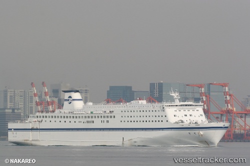
Kiso
Current StatusWhere is the vessel?
Kiso is currently in Near Tomakomai, based on AIS data received about 1d ago.
Latest AIS update:
Current position: 42.63752° N, 141.63605° E (Near Tomakomai)
Average speed (last 7 days): Loading…
Average speed (last 30 days): Loading…
Vessel profile: Kiso is a Passenger Ro Ro Cargo Ship with dimensions 27m x 200m.
This page combines live AIS, route history, probable destination signals, nearby traffic, and port activity for practical vessel monitoring.
The current position of vessel Kiso is 42.63752 lat / 141.63605 lng. Updated: 2026-04-10 07:03:02 UTCNearest reference points:
- Near Muroran
- 23 nm NE of SAI
- 11 nm NW of Yokohama, Aomori
Details:
Live Vessel Kiso Analytics (details, animations, etc.)
Recent AIS points (UTC):
2026-04-10 02:33:02 UTC · 42.63750, 141.63603 · SOG 0 kn · COG 63°2026-04-10 03:30:02 UTC · 42.63755, 141.63609 · SOG 0 kn · COG 63°
2026-04-10 06:00:02 UTC · 42.63753, 141.63605 · SOG 0 kn · COG 63°
2026-04-10 07:03:02 UTC · 42.63752, 141.63605 · SOG 0 kn · COG 63°