 vesseltracker.com
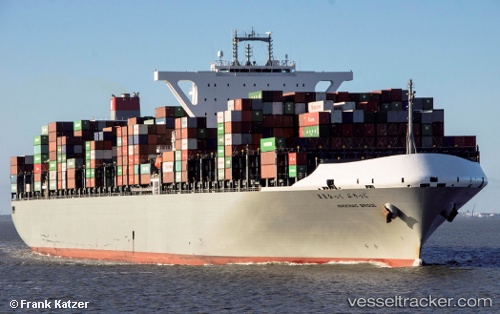
 Mackinac Bridge
Current Status
Where is the vessel?
Mackinac Bridge is currently in 350 nm SW of Luderitz Bay, based on AIS data received less than 1h ago.
Latest AIS update:
Current position: 28.76818° S, 9.02122° E (350 nm SW of Luderitz Bay)
Average speed (last 7 days): Loading…
Average speed (last 30 days): Loading…
Vessel profile: Mackinac Bridge is a Container Ship with dimensions 366m x 366m.
This page combines live AIS, route history, probable destination signals, nearby traffic, and port activity for practical vessel monitoring.
The current position of vessel Mackinac Bridge is -28.76818 lat / 9.02122 lng. Updated: 2026-04-15 21:29:01 UTCNearest reference points:
- Open sea, approx. 402 nm off the nearest listed port
- Open sea, approx. 404 nm off the nearest listed port
- Open sea, approx. 407 nm off the nearest listed port
Currently sailing under the flag of Japan ![]()
Details:
Live Vessel Mackinac Bridge Analytics (details, animations, etc.)
Recent AIS points (UTC):
2026-04-15 15:49:35 UTC · -27.81127, 8.18057 · SOG 12.3 kn · COG 145°2026-04-15 17:22:25 UTC · -28.06499, 8.39400 · SOG 12.2 kn · COG 145°
2026-04-15 19:50:23 UTC · -28.47223, 8.75081 · SOG 12.4 kn · COG 145°
2026-04-15 21:29:01 UTC · -28.76818, 9.02122 · SOG 14.1 kn · COG 145°