 vesseltracker.com
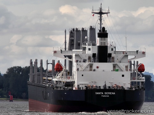
Santa Serena
Current StatusWhere is the vessel?
Santa Serena is currently in 157 nm E of Lenard Harbour, based on AIS data received about 1h ago.
Latest AIS update:
Current position: 54.52487° N, 157.99971° W (157 nm E of Lenard Harbour)
Average speed (last 7 days): Loading…
Average speed (last 30 days): Loading…
Vessel profile: Santa Serena is a General Cargo Ship with dimensions 31m x 185m.
This page combines live AIS, route history, probable destination signals, nearby traffic, and port activity for practical vessel monitoring.
The current position of vessel Santa Serena is 54.52487 lat / -157.99971 lng. Updated: 2026-04-18 13:29:22 UTCDetails:
Live Vessel Santa Serena Analytics (details, animations, etc.)
Recent AIS points (UTC):
2026-04-18 07:32:44 UTC · 55.00623, -156.44232 · SOG 10.3 kn · COG 247°2026-04-18 09:55:36 UTC · 54.81425, -157.08810 · SOG 10.7 kn · COG 242°
2026-04-18 11:59:02 UTC · 54.64651, -157.63271 · SOG 10.1 kn · COG 235°
2026-04-18 13:29:22 UTC · 54.52487, -157.99971 · SOG 9.9 kn · COG 240°