 vesseltracker.com
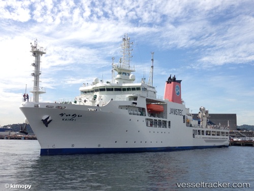
 Kaimei
Current Status
Where is the vessel?
Kaimei is currently in Near Yokosuka, based on AIS data received less than 1h ago.
Latest AIS update:
Current position: 35.31875° N, 139.64989° E (Near Yokosuka)
Average speed (last 7 days): Loading…
Average speed (last 30 days): Loading…
Vessel profile: Kaimei is a Research Vessel with dimensions 100m x 21m.
This page combines live AIS, route history, probable destination signals, nearby traffic, and port activity for practical vessel monitoring.
The current position of vessel Kaimei is 35.31875 lat / 139.64989 lng. Updated: 2026-04-20 04:21:19 UTCNearest reference points:
- Near Naka-Ku, Kanagawa
- Near Yokosuka
- Near Yokohama
Currently sailing under the flag of Japan ![]()
Details:
Live Vessel Kaimei Analytics (details, animations, etc.)
Recent AIS points (UTC):
2026-04-20 02:03:19 UTC · 35.31872, 139.64989 · SOG 0 kn · COG 56°2026-04-20 02:24:19 UTC · 35.31874, 139.64990 · SOG 0 kn · COG 56°
2026-04-20 04:15:19 UTC · 35.31874, 139.64992 · SOG 0 kn · COG 56°
2026-04-20 04:21:19 UTC · 35.31875, 139.64989 · SOG 0 kn · COG 56°