 vesseltracker.com
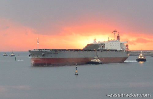
Corona Kingdom
Current StatusWhere is the vessel?
Corona Kingdom is currently in Near AKASHI, based on AIS data received about 19d ago.
Latest AIS update:
Current position: 34.61995° N, 135.00511° E (Near AKASHI)
Average speed (last 7 days): Loading…
Average speed (last 30 days): Loading…
Vessel profile: Corona Kingdom is a Ore Carrier with dimensions 38m x 229m.
This page combines live AIS, route history, probable destination signals, nearby traffic, and port activity for practical vessel monitoring.
The current position of vessel Corona Kingdom is 34.61995 lat / 135.00511 lng. Updated: 2026-03-16 16:51:48 UTCNearest reference points:
- Near AKASHI
- Near Awaji
- Near Hyogo
Details:
Live Vessel Corona Kingdom Analytics (details, animations, etc.)
Recent AIS points (UTC):
2026-03-16 16:51:48 UTC · 34.61995, 135.00511 · SOG 12.2 kn · COG 85°