 vesseltracker.com
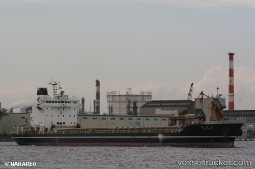
 Mine Maru
Current Status
Where is the vessel?
Mine Maru is currently in 23 nm S of Kosai, based on AIS data received about 1h ago.
Latest AIS update:
Current position: 34.34072° N, 137.41937° E (23 nm S of Kosai)
Average speed (last 7 days): Loading…
Average speed (last 30 days): Loading…
Vessel profile: Mine Maru is a Limestone Carrier with dimensions 129m x 20m.
This page combines live AIS, route history, probable destination signals, nearby traffic, and port activity for practical vessel monitoring.
The current position of vessel Mine Maru is 34.34072 lat / 137.41937 lng. Updated: 2026-04-22 17:48:19 UTCNearest reference points:
- 17 nm S of TOYOHASHI
- 12 nm E of TOBA
- Near TOYOHASHI
Currently sailing under the flag of Japan ![]()
Mine Maru built in 1997 year
Deadweight:
10249 tDetails:
Live Vessel Mine Maru Analytics (details, animations, etc.)
Recent AIS points (UTC):
2026-04-22 13:30:07 UTC · 34.50500, 138.58333 · SOG 13 kn · COG -1°2026-04-22 15:47:45 UTC · 34.43512, 137.97273 · SOG 13 kn · COG -1°
2026-04-22 16:15:22 UTC · 34.41473, 137.84103 · SOG 13.5 kn · COG 259°
2026-04-22 17:48:19 UTC · 34.34072, 137.41937 · SOG 13.7 kn · COG 259°