 vesseltracker.com
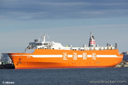
Nanotsu
Current StatusWhere is the vessel?
Nanotsu is currently in 11 nm NW of Koga, based on AIS data received less than 1h ago.
Latest AIS update:
Current position: 33.84533° N, 130.32242° E (11 nm NW of Koga)
Average speed (last 7 days): Loading…
Average speed (last 30 days): Loading…
Vessel profile: Nanotsu is a Ro Ro Cargo Ship with dimensions 24m x 168m.
This page combines live AIS, route history, probable destination signals, nearby traffic, and port activity for practical vessel monitoring.
The current position of vessel Nanotsu is 33.84533 lat / 130.32242 lng. Updated: 2026-04-21 06:18:33 UTCNearest reference points:
- Near Hakata
- Near Hibiki-Nada
- Near Hibikishinko
Details:
Live Vessel Nanotsu Analytics (details, animations, etc.)
Recent AIS points (UTC):
2026-04-21 00:54:11 UTC · 35.00183, 131.82465 · SOG 19.6 kn · COG 234°2026-04-21 03:45:23 UTC · 34.46272, 130.92412 · SOG 19 kn · COG 235°
2026-04-21 04:38:02 UTC · 34.27655, 130.68674 · SOG 19.1 kn · COG 222°
2026-04-21 06:18:33 UTC · 33.84533, 130.32242 · SOG 19.3 kn · COG 202°