 vesseltracker.com
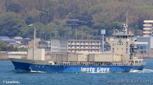
 Tenma
Tenma
Current Status
Where is the vessel?
Tenma is currently in Near MARUGAME, based on AIS data received less than 1h ago.
Latest AIS update:
Current position: 34.37038° N, 133.77679° E (Near MARUGAME)
Average speed (last 7 days): Loading…
Average speed (last 30 days): Loading…
Vessel profile: Tenma is a Container Ship with dimensions 80m x 13m.
This page combines live AIS, route history, probable destination signals, nearby traffic, and port activity for practical vessel monitoring.
The current position of vessel Tenma is 34.37038 lat / 133.77679 lng. Updated: 2026-04-08 13:33:00 UTCNearest reference points:
- Near Sakaide
- Near MIZUSHIMA
- Near Ayagawa
Currently sailing under the flag of Japan ![]()
Details:
Live Vessel Tenma Analytics (details, animations, etc.)
Recent AIS points (UTC):
2026-04-08 07:34:29 UTC · 34.60019, 135.06361 · SOG 9.4 kn · COG 275°2026-04-08 09:37:40 UTC · 34.52533, 134.69020 · SOG 11.2 kn · COG 250°
2026-04-08 12:12:29 UTC · 34.43938, 134.11137 · SOG 12.9 kn · COG 280°
2026-04-08 13:33:00 UTC · 34.37038, 133.77679 · SOG 13.1 kn · COG 248°