 vesseltracker.com
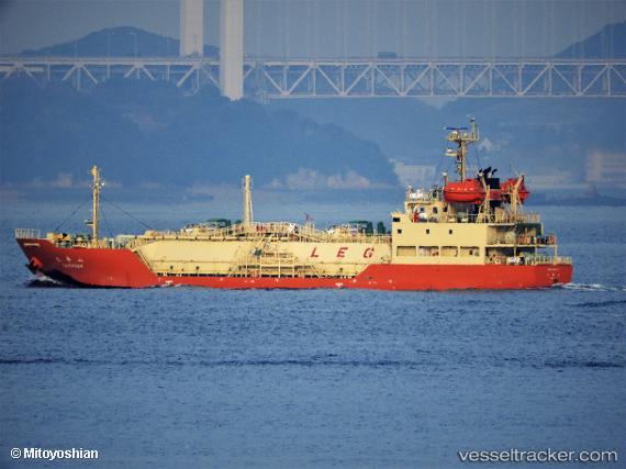
 Taikasan
Current Status
Where is the vessel?
Taikasan is currently in Near Chibai, based on AIS data received about 2h ago.
Latest AIS update:
Current position: 35.47758° N, 139.90709° E (Near Chibai)
Average speed (last 7 days): Loading…
Average speed (last 30 days): Loading…
Vessel profile: Taikasan is a Lpg Tanker with dimensions 74m x 13m.
This page combines live AIS, route history, probable destination signals, nearby traffic, and port activity for practical vessel monitoring.
The current position of vessel Taikasan is 35.47758 lat / 139.90709 lng. Updated: 2026-04-07 15:30:48 UTCNearest reference points:
- Near ANEGASAKI
- Near Aomi
- Near Kawasaki
Currently sailing under the flag of Japan ![]()
Details:
Live Vessel Taikasan Analytics (details, animations, etc.)
Recent AIS points (UTC):
2026-04-07 09:24:48 UTC · 35.47817, 139.90730 · SOG 0.2 kn · COG 337°2026-04-07 11:24:44 UTC · 35.47786, 139.90669 · SOG 0.3 kn · COG 5°
2026-04-07 13:54:46 UTC · 35.47768, 139.90697 · SOG 0.3 kn · COG 343°
2026-04-07 15:30:48 UTC · 35.47758, 139.90709 · SOG 0.2 kn · COG 339°