 vesseltracker.com
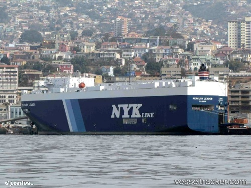
Mercury Leader
Current StatusWhere is the vessel?
Mercury Leader is currently in 254 nm E of Tsuzuki Ku, based on AIS data received about 5h ago.
Latest AIS update:
Current position: 34.06650° N, 134.72543° W (254 nm E of Tsuzuki Ku)
Average speed (last 7 days): Loading…
Average speed (last 30 days): Loading…
Vessel profile: Mercury Leader is a Vehicles Carrier with dimensions 28m x 186m.
This page combines live AIS, route history, probable destination signals, nearby traffic, and port activity for practical vessel monitoring.
The current position of vessel Mercury Leader is 34.06650 lat / -134.72543 lng. Updated: 2026-04-05 09:54:26 UTCNearest reference points:
- Open sea, approx. 402 nm off the nearest listed port
- Open sea, approx. 412 nm off the nearest listed port
- Open sea, approx. 409 nm off the nearest listed port
Details:
Live Vessel Mercury Leader Analytics (details, animations, etc.)
Recent AIS points (UTC):
2026-04-05 04:46:02 UTC · 34.05060, -133.16795 · SOG 15.7 kn · COG 270°2026-04-05 05:59:44 UTC · 34.05663, -133.54655 · SOG 15.3 kn · COG 270°
2026-04-05 07:53:32 UTC · 34.05951, -134.12050 · SOG 15.2 kn · COG 267°
2026-04-05 09:54:26 UTC · 34.06650, -134.72543 · SOG 14.8 kn · COG 268°