 vesseltracker.com
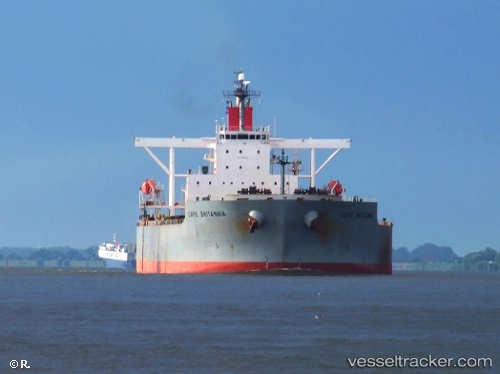
Cape Britannia
Current StatusWhere is the vessel?
Cape Britannia is currently in Near Morro Redondo, based on AIS data received less than 1h ago.
Latest AIS update:
Current position: 28.06852° N, 115.15895° W (Near Morro Redondo)
Average speed (last 7 days): Loading…
Average speed (last 30 days): Loading…
Vessel profile: Cape Britannia is a Ore Carrier with dimensions 45m x 292m.
This page combines live AIS, route history, probable destination signals, nearby traffic, and port activity for practical vessel monitoring.
The current position of vessel Cape Britannia is 28.06852 lat / -115.15895 lng. Updated: 2026-04-16 12:14:51 UTCNearest reference points:
- 32 nm NW of Punta Baja
- 38 nm W of Loreto
Details:
Live Vessel Cape Britannia Analytics (details, animations, etc.)
Recent AIS points (UTC):
2026-04-16 05:50:50 UTC · 28.06945, -115.16288 · SOG 0.2 kn · COG 77°2026-04-16 07:56:51 UTC · 28.07278, -115.15978 · SOG 0.3 kn · COG 192°
2026-04-16 10:23:49 UTC · 28.06860, -115.16148 · SOG 0.3 kn · COG 39°
2026-04-16 12:14:51 UTC · 28.06852, -115.15895 · SOG 0.1 kn · COG 338°