 vesseltracker.com
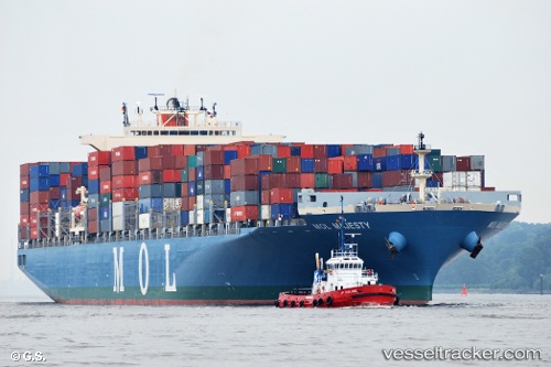
 ONE MAJESTY
Current Status
Where is the vessel?
ONE MAJESTY is currently in Near Savannah, based on AIS data received about 84d ago.
Latest AIS update:
Current position: 32.12925° N, 81.13895° W (Near Savannah)
Average speed (last 7 days): Loading…
Average speed (last 30 days): Loading…
Vessel profile: ONE MAJESTY is a Container Ship with dimensions m x m.
This page combines live AIS, route history, probable destination signals, nearby traffic, and port activity for practical vessel monitoring.
The current position of vessel ONE MAJESTY is 32.12925 lat / -81.13895 lng. Updated: 2026-01-21 09:15:38 UTCNearest reference points:
- Near Saint Andrews
- Near Brunswick
- 33 nm S of Kiawah Island
Currently sailing under the flag of Japan ![]()
Details:
Live Vessel ONE MAJESTY Analytics (details, animations, etc.)
Recent AIS points (UTC):
2026-01-21 09:15:38 UTC · 32.12925, -81.13895 · SOG 0 kn · COG 140°