 vesseltracker.com
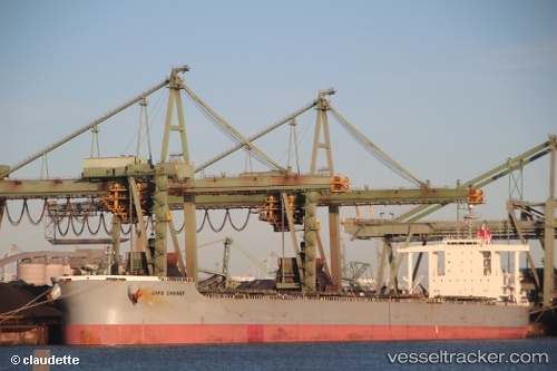
 Cape Canary
Current Status
Where is the vessel?
Cape Canary is currently in 44 nm SE of KANNOURA, based on AIS data received about 1h ago.
Latest AIS update:
Current position: 32.89833° N, 134.71333° E (44 nm SE of KANNOURA)
Average speed (last 7 days): Loading…
Average speed (last 30 days): Loading…
Vessel profile: Cape Canary is a Bulk Carrier with dimensions 292m x 46m.
This page combines live AIS, route history, probable destination signals, nearby traffic, and port activity for practical vessel monitoring.
The current position of vessel Cape Canary is 32.89833 lat / 134.71333 lng. Updated: 2026-04-22 23:25:06 UTCNearest reference points:
- 40 nm SW of Minachi
- 18 nm SE of Gobo Wakayama
- 12 nm S of Gobo Wakayama
Currently sailing under the flag of Japan ![]()
Cape Canary built in 2009 year
Deadweight:
182577 tDetails:
Live Vessel Cape Canary Analytics (details, animations, etc.)
Recent AIS points (UTC):
2026-04-22 19:51:51 UTC · 33.41223, 134.82928 · SOG 9.5 kn · COG 195°2026-04-22 21:25:00 UTC · 33.19500, 134.77499 · SOG 8 kn · COG -1°
2026-04-22 22:19:45 UTC · 33.06263, 134.74608 · SOG 8.9 kn · COG 194°
2026-04-22 23:25:06 UTC · 32.89833, 134.71333 · SOG 9 kn · COG -1°