 vesseltracker.com
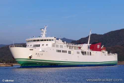
Oita
Current StatusWhere is the vessel?
Oita is currently in Near IKATA, based on AIS data received about 9h ago.
Latest AIS update:
Current position: 33.37770° N, 132.24023° E (Near IKATA)
Average speed (last 7 days): Loading…
Average speed (last 30 days): Loading…
Vessel profile: Oita is a Passenger Ro Ro Cargo Ship with dimensions 16m x 115m.
This page combines live AIS, route history, probable destination signals, nearby traffic, and port activity for practical vessel monitoring.
The current position of vessel Oita is 33.37770 lat / 132.24023 lng. Updated: 2026-04-07 21:31:50 UTCNearest reference points:
- 18 nm SE of HIKARI
- 11 nm E of SAEKI
- 14 nm SE of HIKARI
Details:
Live Vessel Oita Analytics (details, animations, etc.)
Recent AIS points (UTC):
2026-04-07 21:31:50 UTC · 33.37770, 132.24023 · SOG 19.8 kn · COG 236°2026-04-07 21:31:50 UTC · 33.37770, 132.24023 · SOG 19.8 kn · COG 236°
2026-04-07 21:31:50 UTC · 33.37770, 132.24023 · SOG 19.8 kn · COG 236°
2026-04-07 21:31:50 UTC · 33.37770, 132.24023 · SOG 19.8 kn · COG 236°