 vesseltracker.com
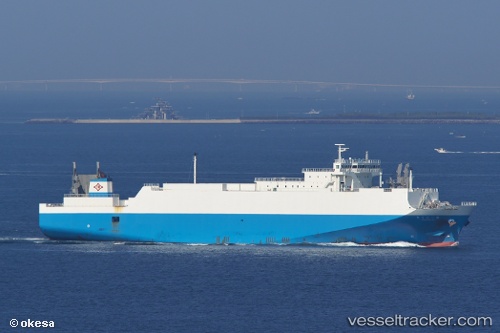
 Harumaru No1
Current Status
Where is the vessel?
Harumaru No1 is currently in Near YURA, based on AIS data received about 1h ago.
Latest AIS update:
Current position: 34.04821° N, 134.96803° E (Near YURA)
Average speed (last 7 days): Loading…
Average speed (last 30 days): Loading…
Vessel profile: Harumaru No1 is a Ro Ro Cargo Ship with dimensions 145m x 25m.
This page combines live AIS, route history, probable destination signals, nearby traffic, and port activity for practical vessel monitoring.
The current position of vessel Harumaru No1 is 34.04821 lat / 134.96803 lng. Updated: 2026-04-09 19:38:42 UTCNearest reference points:
- Near SHIMOTSU
- Near TOKUSHIMA
- Near KADA
Currently sailing under the flag of Japan ![]()
Harumaru No1 built in 2006 year
Deadweight:
4299 tDetails:
Live Vessel Harumaru No1 Analytics (details, animations, etc.)
Recent AIS points (UTC):
2026-04-09 13:52:54 UTC · 32.95333, 133.82666 · SOG 19 kn · COG -1°2026-04-09 15:34:58 UTC · 33.25500, 134.35834 · SOG 18 kn · COG -1°
2026-04-09 18:22:18 UTC · 33.71081, 134.78896 · SOG 18.4 kn · COG 36°
2026-04-09 19:38:42 UTC · 34.04821, 134.96803 · SOG 19.2 kn · COG 5°