 vesseltracker.com
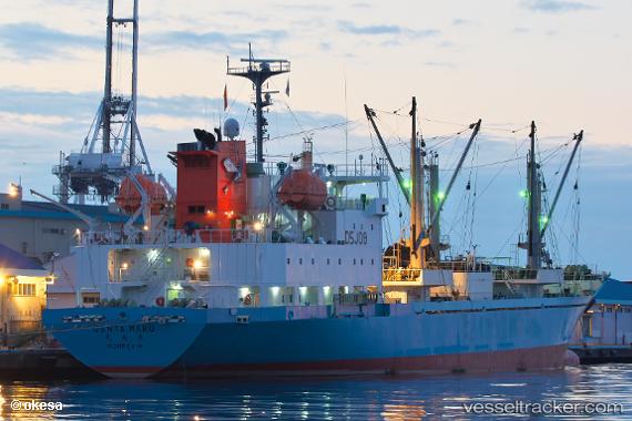
 GENTA MARU
Current Status
Where is the vessel?
GENTA MARU is currently in 140 nm NE of Ailuk Island, based on AIS data received less than 1h ago.
Latest AIS update:
Current position: 12.14459° N, 171.26212° E (140 nm NE of Ailuk Island)
Average speed (last 7 days): Loading…
Average speed (last 30 days): Loading…
Vessel profile: GENTA MARU is a Cargo with dimensions m x m.
This page combines live AIS, route history, probable destination signals, nearby traffic, and port activity for practical vessel monitoring.
The current position of vessel GENTA MARU is 12.14459 lat / 171.26212 lng. Updated: 2026-04-18 06:03:54 UTCCurrently sailing under the flag of Japan ![]()
Details:
Live Vessel GENTA MARU Analytics (details, animations, etc.)
Recent AIS points (UTC):
2026-04-17 23:25:53 UTC · 11.35738, 172.58037 · SOG 13.4 kn · COG 305°2026-04-18 01:43:47 UTC · 11.63139, 172.12920 · SOG 13.5 kn · COG 301°
2026-04-18 04:24:44 UTC · 11.94934, 171.59219 · SOG 13.7 kn · COG 300°
2026-04-18 06:03:54 UTC · 12.14459, 171.26212 · SOG 13.8 kn · COG 302°