 vesseltracker.com
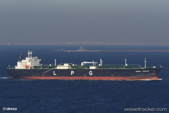
 Sunny Bright
Current Status
Where is the vessel?
Sunny Bright is currently in 13 nm SE of Galveston, based on AIS data received less than 1h ago.
Latest AIS update:
Current position: 29.20529° N, 94.56913° W (13 nm SE of Galveston)
Average speed (last 7 days): Loading…
Average speed (last 30 days): Loading…
Vessel profile: Sunny Bright is a Lpg Tanker with dimensions 230m x 230m.
This page combines live AIS, route history, probable destination signals, nearby traffic, and port activity for practical vessel monitoring.
The current position of vessel Sunny Bright is 29.20529 lat / -94.56913 lng. Updated: 2026-04-04 03:27:57 UTCNearest reference points:
- 12 nm SE of Port Bolivar
- Near Port Bolivar
- Near Texas City
Currently sailing under the flag of Japan ![]()
Sunny Bright built in 2004 year
Deadweight:
49999 tDetails:
Live Vessel Sunny Bright Analytics (details, animations, etc.)
Recent AIS points (UTC):
2026-04-03 21:30:57 UTC · 29.20514, -94.56920 · SOG 0 kn · COG 94°2026-04-04 00:15:59 UTC · 29.20507, -94.56917 · SOG 0.1 kn · COG 90°
2026-04-04 02:07:07 UTC · 29.20504, -94.56920 · SOG 0.1 kn · COG 90°
2026-04-04 03:27:57 UTC · 29.20529, -94.56913 · SOG 0 kn · COG 97°