 vesseltracker.com
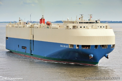
 SWALLOW ACE
Current Status
Where is the vessel?
SWALLOW ACE is currently in 33 nm S of Seaford, based on AIS data received about 2h ago.
Latest AIS update:
Current position: 50.25254° N, 0.20672° W (33 nm S of Seaford)
Average speed (last 7 days): Loading…
Average speed (last 30 days): Loading…
Vessel profile: SWALLOW ACE is a Vehicles Carrier with dimensions m x m.
This page combines live AIS, route history, probable destination signals, nearby traffic, and port activity for practical vessel monitoring.
The current position of vessel SWALLOW ACE is 50.25254 lat / -0.20672 lng. Updated: 2026-03-31 03:23:26 UTCNearest reference points:
- 27 nm S of Seaford
- 23 nm S of Ferring
- 15 nm S of Selsey
Currently sailing under the flag of Japan ![]()
Details:
Live Vessel SWALLOW ACE Analytics (details, animations, etc.)
Recent AIS points (UTC):
2026-03-30 22:02:02 UTC · 49.91802, -2.34565 · SOG 15 kn · COG 74°2026-03-30 23:51:39 UTC · 50.04149, -1.65270 · SOG 15.2 kn · COG 73°
2026-03-31 02:12:05 UTC · 50.16711, -0.72211 · SOG 16.6 kn · COG 82°
2026-03-31 03:23:26 UTC · 50.25254, -0.20672 · SOG 17.7 kn · COG 75°