 vesseltracker.com
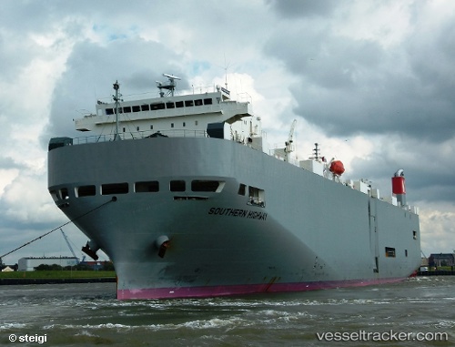
Southern Highway
Current StatusWhere is the vessel?
Southern Highway is currently in 26 nm SW of Parit Raja, based on AIS data received about 1h ago.
Latest AIS update:
Current position: 1.63582° N, 102.74242° E (26 nm SW of Parit Raja)
Average speed (last 7 days): Loading…
Average speed (last 30 days): Loading…
Vessel profile: Southern Highway is a Vehicles Carrier with dimensions 28m x 188m.
This page combines live AIS, route history, probable destination signals, nearby traffic, and port activity for practical vessel monitoring.
The current position of vessel Southern Highway is 1.63582 lat / 102.74242 lng. Updated: 2026-04-10 05:57:28 UTCNearest reference points:
- 29 nm W of Parit Raja
- 12 nm S of Tangkak
- 17 nm NE of Perawang
Details:
Live Vessel Southern Highway Analytics (details, animations, etc.)
Recent AIS points (UTC):
2026-04-10 00:15:47 UTC · 2.51305, 101.46994 · SOG 15.8 kn · COG 127°2026-04-10 01:39:04 UTC · 2.28277, 101.76453 · SOG 16.4 kn · COG 128°
2026-04-10 04:14:58 UTC · 1.84118, 102.31494 · SOG 16.6 kn · COG 117°
2026-04-10 05:57:28 UTC · 1.63582, 102.74242 · SOG 16.8 kn · COG 113°