 vesseltracker.com
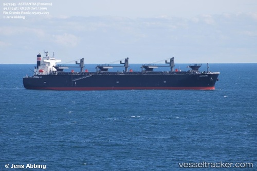
Astrantia
Current StatusWhere is the vessel?
Astrantia is currently in Near TANJUNG PELEPAS, based on AIS data received about 1h ago.
Latest AIS update:
Current position: 1.22554° N, 103.48197° E (Near TANJUNG PELEPAS)
Average speed (last 7 days): Loading…
Average speed (last 30 days): Loading…
Vessel profile: Astrantia is a Wood Chips Carrier with dimensions 36m x 210m.
This page combines live AIS, route history, probable destination signals, nearby traffic, and port activity for practical vessel monitoring.
The current position of vessel Astrantia is 1.22554 lat / 103.48197 lng. Updated: 2026-04-14 18:16:57 UTCNearest reference points:
- Near Nipah
- Near Tuas
- Near Tanjong Bin
Details:
Live Vessel Astrantia Analytics (details, animations, etc.)
Recent AIS points (UTC):
2026-04-14 11:32:59 UTC · 1.25588, 103.88493 · SOG 0.1 kn · COG 49°2026-04-14 13:27:05 UTC · 1.25590, 103.88496 · SOG 0 kn · COG 44°
2026-04-14 15:41:48 UTC · 1.25258, 103.89631 · SOG 5.3 kn · COG 162°
2026-04-14 18:16:57 UTC · 1.22554, 103.48197 · SOG 13 kn · COG 283°