 vesseltracker.com
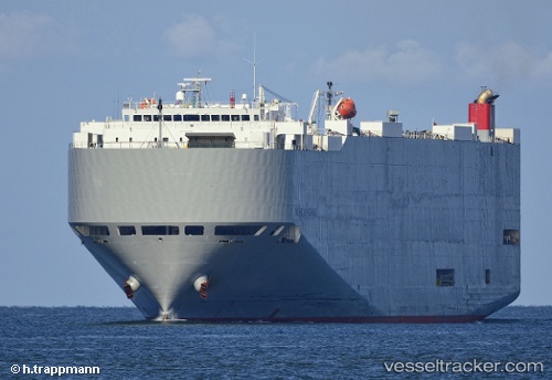
Michigan Highway
Current StatusWhere is the vessel?
Michigan Highway is currently in 40 nm S of Gobo Wakayama, based on AIS data received about 2h ago.
Latest AIS update:
Current position: 33.21911° N, 135.22713° E (40 nm S of Gobo Wakayama)
Average speed (last 7 days): Loading…
Average speed (last 30 days): Loading…
Vessel profile: Michigan Highway is a Vehicles Carrier with dimensions 32m x 199m.
This page combines live AIS, route history, probable destination signals, nearby traffic, and port activity for practical vessel monitoring.
The current position of vessel Michigan Highway is 33.21911 lat / 135.22713 lng. Updated: 2026-04-08 19:33:29 UTCNearest reference points:
- 40 nm SW of Minachi
- 18 nm SE of Gobo Wakayama
- 12 nm S of Gobo Wakayama
Details:
Live Vessel Michigan Highway Analytics (details, animations, etc.)
Recent AIS points (UTC):
2026-04-08 13:32:12 UTC · 33.97702, 136.71841 · SOG 17.3 kn · COG 227°2026-04-08 15:56:39 UTC · 33.44282, 136.20772 · SOG 15.5 kn · COG 227°
2026-04-08 17:54:44 UTC · 33.26813, 135.68205 · SOG 14.3 kn · COG 260°
2026-04-08 19:33:29 UTC · 33.21911, 135.22713 · SOG 15.3 kn · COG 262°