 vesseltracker.com
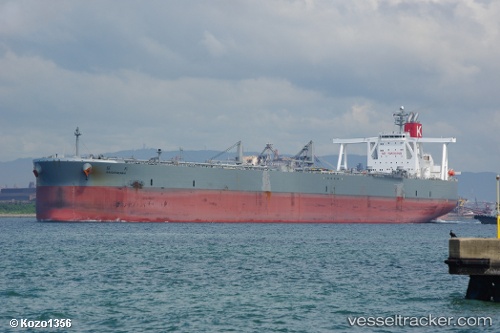
 Sakuragawa
Current Status
Where is the vessel?
Sakuragawa is currently in Near Yokkaichi, based on AIS data received less than 1h ago.
Latest AIS update:
Current position: 34.91928° N, 136.71782° E (Near Yokkaichi)
Average speed (last 7 days): Loading…
Average speed (last 30 days): Loading…
Vessel profile: Sakuragawa is a Crude Oil Tanker with dimensions 333m x 60m.
This page combines live AIS, route history, probable destination signals, nearby traffic, and port activity for practical vessel monitoring.
The current position of vessel Sakuragawa is 34.91928 lat / 136.71782 lng. Updated: 2026-04-13 09:27:22 UTCNearest reference points:
- Near Yokkaichi
- Near Nagoya
- Near Kinuura
Currently sailing under the flag of Japan ![]()
Details:
Live Vessel Sakuragawa Analytics (details, animations, etc.)
Recent AIS points (UTC):
2026-04-13 03:55:51 UTC · 34.92356, 136.71402 · SOG 0.1 kn · COG 155°2026-04-13 06:10:24 UTC · 34.92334, 136.71761 · SOG 0.1 kn · COG -1°
2026-04-13 07:53:53 UTC · 34.92051, 136.71890 · SOG 0.1 kn · COG 257°
2026-04-13 09:27:22 UTC · 34.91928, 136.71782 · SOG 0.1 kn · COG 316°