 vesseltracker.com
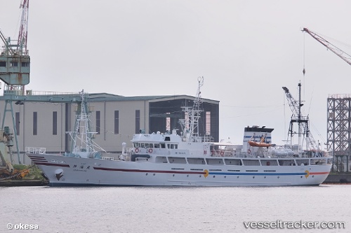
Shinkai Maru
Current StatusWhere is the vessel?
Shinkai Maru is currently in Near ISHINOMAKI, based on AIS data received about 7d ago.
Latest AIS update:
Current position: 38.40979° N, 141.24838° E (Near ISHINOMAKI)
Average speed (last 7 days): Loading…
Average speed (last 30 days): Loading…
Vessel profile: Shinkai Maru is a Fishing Vessel with dimensions 10m x 68m.
This page combines live AIS, route history, probable destination signals, nearby traffic, and port activity for practical vessel monitoring.
The current position of vessel Shinkai Maru is 38.40979 lat / 141.24838 lng. Updated: 2026-04-15 07:27:14 UTCNearest reference points:
- Near ISHINOMAKI
- Near Shiogama
- Near ONAGAWA
Details:
Live Vessel Shinkai Maru Analytics (details, animations, etc.)
Recent AIS points (UTC):
2026-04-14 23:39:20 UTC · 38.40983, 141.24854 · SOG 0 kn · COG -1°2026-04-15 03:48:14 UTC · 38.40988, 141.24831 · SOG 0.1 kn · COG -1°
2026-04-15 06:06:15 UTC · 38.40972, 141.24844 · SOG 0 kn · COG -1°
2026-04-15 07:27:14 UTC · 38.40979, 141.24838 · SOG 0 kn · COG -1°
2026-04-15 07:27:14 UTC · 38.40979, 141.24838 · SOG 0 kn · COG -1°
2026-04-15 07:27:14 UTC · 38.40979, 141.24838 · SOG 0 kn · COG -1°