 vesseltracker.com
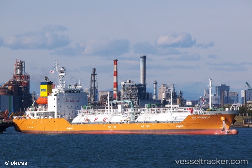
 Gas Oceanroad
Current Status
Where is the vessel?
Gas Oceanroad is currently in Near Cigading, based on AIS data received about 1d ago.
Latest AIS update:
Current position: 6.03455° S, 105.92873° E (Near Cigading)
Average speed (last 7 days): Loading…
Average speed (last 30 days): Loading…
Vessel profile: Gas Oceanroad is a Lpg Tanker with dimensions 96m x 15m.
This page combines live AIS, route history, probable destination signals, nearby traffic, and port activity for practical vessel monitoring.
The current position of vessel Gas Oceanroad is -6.03455 lat / 105.92873 lng. Updated: 2026-04-10 08:09:45 UTCNearest reference points:
- Near Cigading
- Near CIWANDAN
- Near MERAK
Currently sailing under the flag of Korea ![]()
Details:
Live Vessel Gas Oceanroad Analytics (details, animations, etc.)
Recent AIS points (UTC):
2026-04-10 01:31:33 UTC · -5.65583, 106.01077 · SOG 12.3 kn · COG -1°2026-04-10 04:11:23 UTC · -6.01487, 105.91929 · SOG 0.1 kn · COG 272°
2026-04-10 05:53:28 UTC · -6.01457, 105.91922 · SOG 0.2 kn · COG 245°
2026-04-10 08:09:45 UTC · -6.03455, 105.92873 · SOG 0.1 kn · COG 191°