 vesseltracker.com
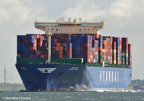
 HYUNDAI HOPE
Current Status
Where is the vessel?
HYUNDAI HOPE is currently in 49 nm SW of Yzerfontein, based on AIS data received about 2h ago.
Latest AIS update:
Current position: 33.82661° S, 17.39621° E (49 nm SW of Yzerfontein)
Average speed (last 7 days): Loading…
Average speed (last 30 days): Loading…
Vessel profile: HYUNDAI HOPE is a Container Ship with dimensions 48m x 366m.
This page combines live AIS, route history, probable destination signals, nearby traffic, and port activity for practical vessel monitoring.
The current position of vessel HYUNDAI HOPE is -33.82661 lat / 17.39621 lng. Updated: 2026-04-15 11:33:57 UTCNearest reference points:
- 12 nm W of ROBBEN ISLAND
- Near HOUT BAY
- Near Cape Town
Currently sailing under the flag of Korea (Republic of) ![]()
HYUNDAI HOPE built in 2014 year
Deadweight:
145683 tDetails:
Live Vessel HYUNDAI HOPE Analytics (details, animations, etc.)
Recent AIS points (UTC):
2026-04-15 05:52:15 UTC · -34.73866, 18.41618 · SOG 12.7 kn · COG 300°2026-04-15 07:24:06 UTC · -34.50685, 18.11516 · SOG 14.3 kn · COG 323°
2026-04-15 10:24:09 UTC · -33.98208, 17.61340 · SOG 12.9 kn · COG 314°
2026-04-15 11:33:57 UTC · -33.82661, 17.39621 · SOG 11.9 kn · COG 316°