 vesseltracker.com
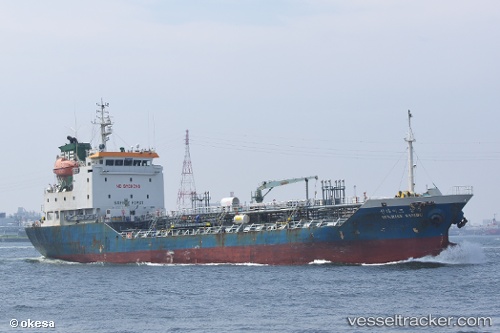
 SUNRISE SAMBU
Current Status
Where is the vessel?
SUNRISE SAMBU is currently in 25 nm E of Minachi, based on AIS data received about 1h ago.
Latest AIS update:
Current position: 33.65393° N, 136.19411° E (25 nm E of Minachi)
Average speed (last 7 days): Loading…
Average speed (last 30 days): Loading…
Vessel profile: SUNRISE SAMBU is a Chemical/Oil Products Tanker with dimensions 92m x 14m.
This page combines live AIS, route history, probable destination signals, nearby traffic, and port activity for practical vessel monitoring.
The current position of vessel SUNRISE SAMBU is 33.65393 lat / 136.19411 lng. Updated: 2026-04-08 23:44:58 UTCNearest reference points:
- 23 nm S of Minachi
- 20 nm S of HAMAJIMA
- 18 nm SE of Gobo Wakayama
Currently sailing under the flag of Korea (Republic of) ![]()
SUNRISE SAMBU built in 2004 year
Deadweight:
3613 tDetails:
Live Vessel SUNRISE SAMBU Analytics (details, animations, etc.)
Recent AIS points (UTC):
2026-04-08 14:45:09 UTC · 33.13860, 134.16486 · SOG 11.1 kn · COG -1°2026-04-08 17:50:30 UTC · 33.26533, 134.90114 · SOG 12.7 kn · COG 79°
2026-04-08 19:33:31 UTC · 33.34157, 135.34467 · SOG 13.2 kn · COG 79°
2026-04-08 23:44:58 UTC · 33.65393, 136.19411 · SOG 10.3 kn · COG 53°