 vesseltracker.com
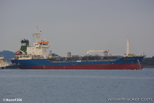
Galaxy Sambu
Current StatusWhere is the vessel?
Galaxy Sambu is currently in 14 nm E of Wenling Longmen Port, based on AIS data received about 23h ago.
Latest AIS update:
Current position: 28.39110° N, 122.25288° E (14 nm E of Wenling Longmen Port)
Average speed (last 7 days): Loading…
Average speed (last 30 days): Loading…
Vessel profile: Galaxy Sambu is a Chemical Oil Products Tanker with dimensions 14m x 88m.
This page combines live AIS, route history, probable destination signals, nearby traffic, and port activity for practical vessel monitoring.
The current position of vessel Galaxy Sambu is 28.39110 lat / 122.25288 lng. Updated: 2026-04-10 08:25:13 UTCNearest reference points:
- 16 nm NE of Wenling Longmen Port
- Near Wenling Longmen Port
- 15 nm S of Wenling Longmen Port
Details:
Live Vessel Galaxy Sambu Analytics (details, animations, etc.)
Recent AIS points (UTC):
2026-04-10 01:26:33 UTC · 27.19263, 121.45088 · SOG 12.3 kn · COG 28°2026-04-10 03:52:02 UTC · 27.60825, 121.73515 · SOG 12 kn · COG 35°
2026-04-10 05:14:32 UTC · 27.84143, 121.89903 · SOG 11 kn · COG 25°
2026-04-10 08:25:13 UTC · 28.39110, 122.25288 · SOG 12.2 kn · COG 30°