 vesseltracker.com
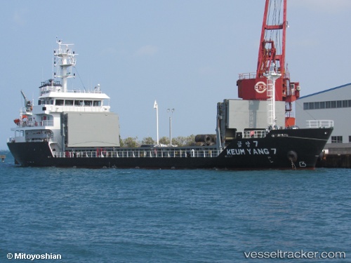
 Keum Yang 7
Current Status
Where is the vessel?
Keum Yang 7 is currently in Near Kobe, based on AIS data received about 16h ago.
Latest AIS update:
Current position: 34.60706° N, 135.29953° E (Near Kobe)
Average speed (last 7 days): Loading…
Average speed (last 30 days): Loading…
Vessel profile: Keum Yang 7 is a General Cargo Ship with dimensions 80m x 80m.
This page combines live AIS, route history, probable destination signals, nearby traffic, and port activity for practical vessel monitoring.
The current position of vessel Keum Yang 7 is 34.60706 lat / 135.29953 lng. Updated: 2026-04-10 08:22:18 UTCNearest reference points:
- Near Nada-Ku, Hyogo
- Near Kobe
- Near SAKAI
Currently sailing under the flag of Korea ![]()
Details:
Live Vessel Keum Yang 7 Analytics (details, animations, etc.)
Recent AIS points (UTC):
2026-04-10 01:49:47 UTC · 34.62589, 135.41071 · SOG 0 kn · COG 90°2026-04-10 03:52:43 UTC · 34.62585, 135.41090 · SOG 0 kn · COG 90°
2026-04-10 05:44:04 UTC · 34.62586, 135.41092 · SOG 0 kn · COG 89°
2026-04-10 08:22:18 UTC · 34.60706, 135.29953 · SOG 9.3 kn · COG 264°