 vesseltracker.com
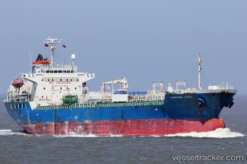
 YC PANSY
Current Status
Where is the vessel?
YC PANSY is currently in 18 nm S of Abu Musa, based on AIS data received less than 1h ago.
Latest AIS update:
Current position: 25.58375° N, 54.89606° E (18 nm S of Abu Musa)
Average speed (last 7 days): Loading…
Average speed (last 30 days): Loading…
Vessel profile: YC PANSY is a Chemical Tanker with dimensions m x m.
This page combines live AIS, route history, probable destination signals, nearby traffic, and port activity for practical vessel monitoring.
The current position of vessel YC PANSY is 25.58375 lat / 54.89606 lng. Updated: 2026-04-19 13:59:07 UTCNearest reference points:
- 17 nm NW of Free Port
- Near Free Port
- Near Sharjah
Currently sailing under the flag of South Korea ![]()
Details:
Live Vessel YC PANSY Analytics (details, animations, etc.)
Recent AIS points (UTC):
2026-04-19 10:11:05 UTC · 25.58415, 54.89601 · SOG 0 kn · COG 46°2026-04-19 11:50:02 UTC · 25.58389, 54.89613 · SOG 0 kn · COG 48°
2026-04-19 13:32:20 UTC · 25.58374, 54.89590 · SOG 0 kn · COG -1°
2026-04-19 13:59:07 UTC · 25.58375, 54.89606 · SOG 0 kn · COG 20°