 vesseltracker.com
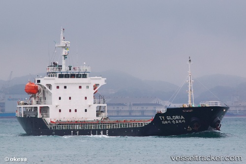
 Ty Gloria
Current Status
Where is the vessel?
Ty Gloria is currently in Near Oita, based on AIS data received less than 1h ago.
Latest AIS update:
Current position: 33.27829° N, 131.65361° E (Near Oita)
Average speed (last 7 days): Loading…
Average speed (last 30 days): Loading…
Vessel profile: Ty Gloria is a General Cargo Ship with dimensions 99m x 99m.
This page combines live AIS, route history, probable destination signals, nearby traffic, and port activity for practical vessel monitoring.
The current position of vessel Ty Gloria is 33.27829 lat / 131.65361 lng. Updated: 2026-04-21 04:14:45 UTCNearest reference points:
- Near Oita
- Near Kitsuki
- 14 nm SW of HIKARI
Currently sailing under the flag of Korea ![]()
Ty Gloria built in 2009 year
Deadweight:
6225 tDetails:
Live Vessel Ty Gloria Analytics (details, animations, etc.)
Recent AIS points (UTC):
2026-04-21 00:21:36 UTC · 33.27667, 131.65334 · SOG 0 kn · COG -1°2026-04-21 01:48:05 UTC · 33.27667, 131.65334 · SOG 0 kn · COG -1°
2026-04-21 01:57:04 UTC · 33.27667, 131.65334 · SOG 0 kn · COG -1°
2026-04-21 04:14:45 UTC · 33.27829, 131.65361 · SOG 0 kn · COG -1°