 vesseltracker.com
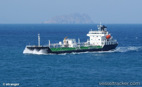
Hanyu Empire
Current StatusWhere is the vessel?
Hanyu Empire is currently in Near LANSHAN, based on AIS data received less than 1h ago.
Latest AIS update:
Current position: 35.09980° N, 119.38682° E (Near LANSHAN)
Average speed (last 7 days): Loading…
Average speed (last 30 days): Loading…
Vessel profile: Hanyu Empire is a Bitumen Tanker with dimensions 17m x 102m.
This page combines live AIS, route history, probable destination signals, nearby traffic, and port activity for practical vessel monitoring.
The current position of vessel Hanyu Empire is 35.09980 lat / 119.38682 lng. Updated: 2026-04-13 09:57:41 UTCNearest reference points:
- Near LANSHAN
- Near Lanshan Pt
- Near Rizhao
Details:
Live Vessel Hanyu Empire Analytics (details, animations, etc.)
Recent AIS points (UTC):
2026-04-13 04:20:46 UTC · 35.06915, 119.66152 · SOG 0 kn · COG 78°2026-04-13 05:26:43 UTC · 35.06918, 119.66164 · SOG 0 kn · COG 79°
2026-04-13 07:22:01 UTC · 35.04362, 119.58118 · SOG 9.3 kn · COG 272°
2026-04-13 09:57:41 UTC · 35.09980, 119.38682 · SOG 0 kn · COG 261°