 vesseltracker.com
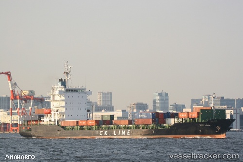
 SKY HOPE
Current Status
Where is the vessel?
SKY HOPE is currently in 12 nm SE of Wenling Longmen Port, based on AIS data received about 2h ago.
Latest AIS update:
Current position: 28.24026° N, 122.10447° E (12 nm SE of Wenling Longmen Port)
Average speed (last 7 days): Loading…
Average speed (last 30 days): Loading…
Vessel profile: SKY HOPE is a Cargo with dimensions m x m.
This page combines live AIS, route history, probable destination signals, nearby traffic, and port activity for practical vessel monitoring.
The current position of vessel SKY HOPE is 28.24026 lat / 122.10447 lng. Updated: 2026-04-18 13:42:58 UTCNearest reference points:
- 15 nm S of Wenling Longmen Port
- 12 nm S of Wenling Longmen Port
- Near Wenling Longmen Port
Currently sailing under the flag of South Korea ![]()
Details:
Live Vessel SKY HOPE Analytics (details, animations, etc.)
Recent AIS points (UTC):
2026-04-18 07:43:10 UTC · 29.55076, 122.79608 · SOG 15.8 kn · COG 201°2026-04-18 10:15:10 UTC · 28.93872, 122.59114 · SOG 14 kn · COG 189°
2026-04-18 11:41:09 UTC · 28.63572, 122.39860 · SOG 14.4 kn · COG 207°
2026-04-18 13:42:58 UTC · 28.24026, 122.10447 · SOG 13.9 kn · COG 211°