 vesseltracker.com
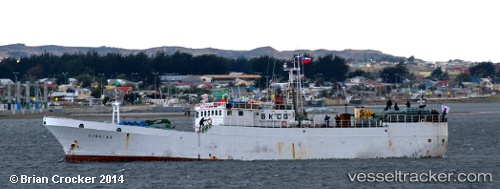
Sunstar
Current StatusWhere is the vessel?
Sunstar is currently in 144 nm E of Port William, based on AIS data received less than 1h ago.
Latest AIS update:
Current position: 52.05987° S, 53.97963° W (144 nm E of Port William)
Average speed (last 7 days): Loading…
Average speed (last 30 days): Loading…
Vessel profile: Sunstar is a Fishing Vessel with dimensions 10m x 60m.
This page combines live AIS, route history, probable destination signals, nearby traffic, and port activity for practical vessel monitoring.
The current position of vessel Sunstar is -52.05987 lat / -53.97963 lng. Updated: 2026-04-13 09:38:07 UTCDetails:
Live Vessel Sunstar Analytics (details, animations, etc.)
Recent AIS points (UTC):
2026-04-13 04:04:52 UTC · -52.85212, -53.44325 · SOG 8.8 kn · COG 337°2026-04-13 06:06:30 UTC · -52.56629, -53.64218 · SOG 9.3 kn · COG 337°
2026-04-13 08:03:46 UTC · -52.28866, -53.83010 · SOG 9.1 kn · COG 339°
2026-04-13 09:38:07 UTC · -52.05987, -53.97963 · SOG 9.6 kn · COG 336°