 vesseltracker.com
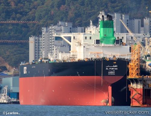
Al Funtas
Current StatusWhere is the vessel?
Al Funtas is currently in 49 nm SE of Offshore Fujairah, based on AIS data received about 17h ago.
Latest AIS update:
Current position: 24.78135° N, 57.41118° E (49 nm SE of Offshore Fujairah)
Average speed (last 7 days): Loading…
Average speed (last 30 days): Loading…
Vessel profile: Al Funtas is a Crude Oil Tanker with dimensions 60m x 333m.
This page combines live AIS, route history, probable destination signals, nearby traffic, and port activity for practical vessel monitoring.
The current position of vessel Al Funtas is 24.78135 lat / 57.41118 lng. Updated: 2026-04-10 06:49:59 UTCNearest reference points:
- 42 nm SE of Offshore Fujairah
- 18 nm SE of SHINAS
- 58 nm S of JASK
Details:
Live Vessel Al Funtas Analytics (details, animations, etc.)
Recent AIS points (UTC):
2026-04-10 02:25:09 UTC · 24.79414, 57.37679 · SOG 0.6 kn · COG 358°2026-04-10 03:50:30 UTC · 24.79504, 57.38814 · SOG 0.3 kn · COG 243°
2026-04-10 06:06:00 UTC · 24.78481, 57.40311 · SOG 0.5 kn · COG 207°
2026-04-10 06:49:59 UTC · 24.78135, 57.41118 · SOG 0.7 kn · COG 187°