 vesseltracker.com
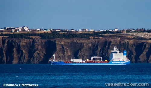
 Clipper
Current Status
Where is the vessel?
Clipper is currently in 20 nm NW of Pangkur, based on AIS data received about 307d ago.
Latest AIS update:
Current position: 4.41311° N, 100.29186° E (20 nm NW of Pangkur)
Average speed (last 7 days): Loading…
Average speed (last 30 days): Loading…
Vessel profile: Clipper is a Oil Products Tanker with dimensions 116m x 116m.
This page combines live AIS, route history, probable destination signals, nearby traffic, and port activity for practical vessel monitoring.
The current position of vessel Clipper is 4.41311 lat / 100.29186 lng. Updated: 2025-06-07 14:02:48 UTCNearest reference points:
- 11 nm W of Pangkur
- Near PANGKOR
- Near Simpang Lima
Currently sailing under the flag of Cook Is ![]()
Clipper built in 1993 year
Deadweight:
9176 tDetails:
Live Vessel Clipper Analytics (details, animations, etc.)
Recent AIS points (UTC):
2025-06-07 14:02:48 UTC · 4.41311, 100.29186 · SOG 4.5 kn · COG -1°