 vesseltracker.com
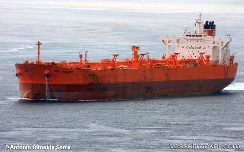
 SELVA
SELVA
Current Status
Where is the vessel?
SELVA is currently in 128 nm NW of FREDVANG, based on AIS data received about 2h ago.
Latest AIS update:
Current position: 69.56500° N, 8.91833° E (128 nm NW of FREDVANG)
Average speed (last 7 days): Loading…
Average speed (last 30 days): Loading…
Vessel profile: SELVA is a Crude Oil Tanker with dimensions m x m.
This page combines live AIS, route history, probable destination signals, nearby traffic, and port activity for practical vessel monitoring.
The current position of vessel SELVA is 69.56500 lat / 8.91833 lng. Updated: 2026-04-18 13:55:11 UTCCurrently sailing under the flag of Oman ![]()
Details:
Live Vessel SELVA Analytics (details, animations, etc.)
Recent AIS points (UTC):
2026-04-18 07:58:06 UTC · 68.76333, 6.34833 · SOG 11 kn · COG -1°2026-04-18 09:49:15 UTC · 69.00646, 7.09756 · SOG 11.8 kn · COG 55°
2026-04-18 12:03:55 UTC · 69.32630, 8.03589 · SOG 12.6 kn · COG 56°
2026-04-18 13:55:11 UTC · 69.56500, 8.91833 · SOG 12 kn · COG -1°