 vesseltracker.com
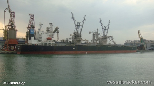
Malakand
Current StatusWhere is the vessel?
Malakand is currently in 115 nm SE of Puerto Princesa, based on AIS data received about 4h ago.
Latest AIS update:
Current position: 8.67653° N, 120.34419° E (115 nm SE of Puerto Princesa)
Average speed (last 7 days): Loading…
Average speed (last 30 days): Loading…
Vessel profile: Malakand is a Bulk Carrier with dimensions 32m x 225m.
This page combines live AIS, route history, probable destination signals, nearby traffic, and port activity for practical vessel monitoring.
The current position of vessel Malakand is 8.67653 lat / 120.34419 lng. Updated: 2026-04-17 03:09:20 UTCNearest reference points:
- 21 nm NW of Zamboanga
- 35 nm SE of Brookes Point, Palawan
- 66 nm W of Jolo
Details:
Live Vessel Malakand Analytics (details, animations, etc.)
Recent AIS points (UTC):
2026-04-16 23:28:49 UTC · 8.00615, 120.26757 · SOG 10.8 kn · COG -1°2026-04-17 02:04:10 UTC · 8.47581, 120.33440 · SOG 11 kn · COG -1°
2026-04-17 03:09:20 UTC · 8.67653, 120.34419 · SOG 11 kn · COG -1°
2026-04-17 03:09:20 UTC · 8.67653, 120.34419 · SOG 11 kn · COG -1°