 vesseltracker.com
 NEPTUNE ISLAND
Current Status
Where is the vessel?
NEPTUNE ISLAND is currently in Near Taicang, based on AIS data received about 2h ago.
Latest AIS update:
Current position: 31.72707° N, 121.11028° E (Near Taicang)
Average speed (last 7 days): Loading…
Average speed (last 30 days): Loading…
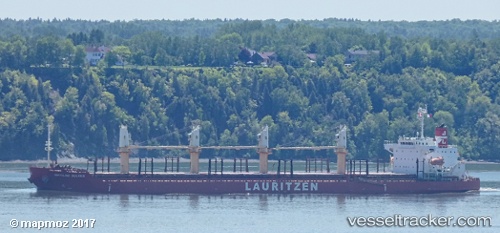
Vessel profile: NEPTUNE ISLAND is a Bulk Carrier with dimensions 185m x 31m.
This page combines live AIS, route history, probable destination signals, nearby traffic, and port activity for practical vessel monitoring.
The current position of vessel NEPTUNE ISLAND is 31.72707 lat / 121.11028 lng. Updated: 2026-04-18 07:52:34 UTCNearest reference points:
- Near Taicang
- 11 nm NW of Taicang
- 10 nm NW of Taicang
Currently sailing under the flag of Hong Kong, China ![]()
NEPTUNE ISLAND built in 2012 year
Deadweight:
38191 tDetails:
Live Vessel NEPTUNE ISLAND Analytics (details, animations, etc.)
Recent AIS points (UTC):
2026-04-17 23:31:36 UTC · 32.31990, 119.72934 · SOG 0 kn · COG 230°2026-04-18 03:52:30 UTC · 32.01309, 120.39668 · SOG 14.2 kn · COG 60°
2026-04-18 05:34:33 UTC · 32.00379, 120.80507 · SOG 11.6 kn · COG 115°
2026-04-18 07:52:34 UTC · 31.72707, 121.11028 · SOG 10.8 kn · COG 138°