 vesseltracker.com
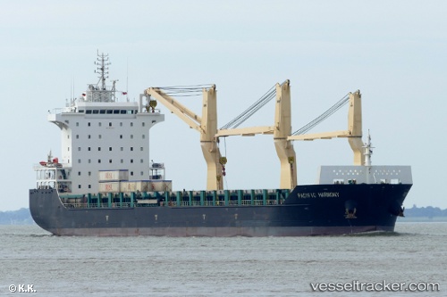
Pacific Harmony
Current StatusWhere is the vessel?
Pacific Harmony is currently in Near Port Said East, based on AIS data received about 1h ago.
Latest AIS update:
Current position: 31.21785° N, 32.34297° E (Near Port Said East)
Average speed (last 7 days): Loading…
Average speed (last 30 days): Loading…
Vessel profile: Pacific Harmony is a Multi Purpose Carrier with dimensions 28m x 168m.
This page combines live AIS, route history, probable destination signals, nearby traffic, and port activity for practical vessel monitoring.
The current position of vessel Pacific Harmony is 31.21785 lat / 32.34297 lng. Updated: 2026-04-20 04:30:15 UTCNearest reference points:
- Near Port Said East
- Near Port Said
- 14 nm N of Port Said
Details:
Live Vessel Pacific Harmony Analytics (details, animations, etc.)
Recent AIS points (UTC):
2026-04-20 01:14:06 UTC · 31.41095, 32.27426 · SOG 0.3 kn · COG -1°2026-04-20 01:52:52 UTC · 31.41104, 32.27369 · SOG 0.5 kn · COG 306°
2026-04-20 03:38:25 UTC · 31.33907, 32.37854 · SOG 9.2 kn · COG 199°
2026-04-20 04:30:15 UTC · 31.21785, 32.34297 · SOG 5.2 kn · COG 193°