 vesseltracker.com
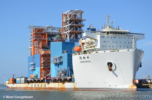
Xiang He Kou
Current StatusWhere is the vessel?
Xiang He Kou is currently in Near Huangpu New Port, based on AIS data received less than 1h ago.
Latest AIS update:
Current position: 23.08167° N, 113.47833° E (Near Huangpu New Port)
Average speed (last 7 days): Loading…
Average speed (last 30 days): Loading…
Vessel profile: Xiang He Kou is a Heavy Load Carrier with dimensions 43m x 217m.
This page combines live AIS, route history, probable destination signals, nearby traffic, and port activity for practical vessel monitoring.
The current position of vessel Xiang He Kou is 23.08167 lat / 113.47833 lng. Updated: 2026-04-16 14:15:18 UTCNearest reference points:
- Near Huangpu New Port
- Near Shilou
- Near MCID - Private Terminal
Details:
Live Vessel Xiang He Kou Analytics (details, animations, etc.)
Recent AIS points (UTC):
2026-04-16 07:47:51 UTC · 23.08263, 113.47980 · SOG 0 kn · COG 114°2026-04-16 09:29:53 UTC · 23.08264, 113.47978 · SOG 0 kn · COG 114°
2026-04-16 12:21:17 UTC · 23.08167, 113.47833 · SOG 0 kn · COG -1°
2026-04-16 14:15:18 UTC · 23.08167, 113.47833 · SOG 0 kn · COG -1°