 vesseltracker.com
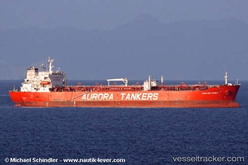
Maritime Gisela
Current StatusWhere is the vessel?
Maritime Gisela is currently in Near Panama, based on AIS data received less than 1h ago.
Latest AIS update:
Current position: 8.89083° N, 79.50317° W (Near Panama)
Average speed (last 7 days): Loading…
Average speed (last 30 days): Loading…
Vessel profile: Maritime Gisela is a Chemical Oil Products Tanker with dimensions 32m x 180m.
This page combines live AIS, route history, probable destination signals, nearby traffic, and port activity for practical vessel monitoring.
The current position of vessel Maritime Gisela is 8.89083 lat / -79.50317 lng. Updated: 2026-04-07 14:01:09 UTCNearest reference points:
- Near Panama
- Near El Chorrillo
- Near Cocoli
Details:
Live Vessel Maritime Gisela Analytics (details, animations, etc.)
Recent AIS points (UTC):
2026-04-07 07:43:11 UTC · 8.89099, -79.50291 · SOG 0.1 kn · COG 22°2026-04-07 09:28:09 UTC · 8.89115, -79.50352 · SOG 0.1 kn · COG 33°
2026-04-07 11:58:11 UTC · 8.89086, -79.50331 · SOG 0 kn · COG 20°
2026-04-07 14:01:09 UTC · 8.89083, -79.50317 · SOG 0 kn · COG 27°