 vesseltracker.com
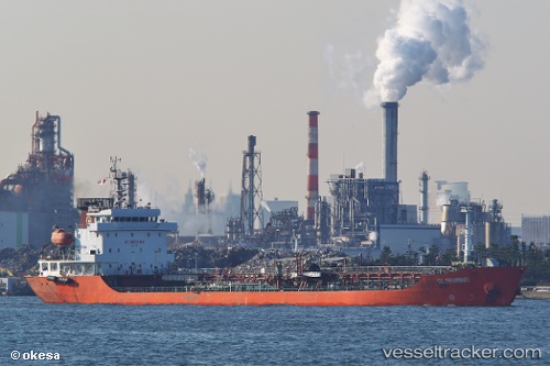
Gloriwind
Current StatusWhere is the vessel?
Gloriwind is currently in 20 nm N of Dokdo, based on AIS data received less than 1h ago.
Latest AIS update:
Current position: 37.55500° N, 131.73090° E (20 nm N of Dokdo)
Average speed (last 7 days): Loading…
Average speed (last 30 days): Loading…
Vessel profile: Gloriwind is a Oil Products Tanker with dimensions 18m x 115m.
This page combines live AIS, route history, probable destination signals, nearby traffic, and port activity for practical vessel monitoring.
The current position of vessel Gloriwind is 37.55500 lat / 131.73090 lng. Updated: 2026-03-29 03:30:29 UTCNearest reference points:
- 33 nm NE of Ulleung-gun
- 94 nm N of Dokdo
- 37 nm NW of NAKANOSHIMA
Details:
Live Vessel Gloriwind Analytics (details, animations, etc.)
Recent AIS points (UTC):
2026-03-28 21:54:34 UTC · 38.19333, 132.40668 · SOG 10 kn · COG -1°2026-03-29 00:05:10 UTC · 37.89846, 132.09563 · SOG 10.4 kn · COG 218°
2026-03-29 01:31:49 UTC · 37.69509, 131.88022 · SOG 11.5 kn · COG 219°
2026-03-29 03:30:29 UTC · 37.55500, 131.73090 · SOG 10.8 kn · COG 217°